
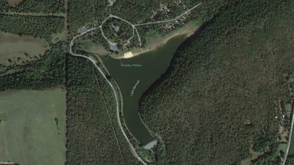
The Lake Bennett Watershed Project was the first project in the United States established to scientifically study the effects of water runoff and erosion control from a specific watershed. Principles tested within the Lake Bennett Watershed laid the foundation for soil conservation practices considered common today. It continues to have historic and symbolic significance. The key component of the project was the construction of Lake Bennet within a 2,138-acre watershed. The dam was constructed in 1935 by the Works Progress Administration and the Civilian Conservation Corps and consists of an earthen structure built around a masonry core. It is named in honor of Hugh Hammond Bennett, the founder of the USDA Soil Conservation Service. Lake Bennett provides water-based recreation opportunities to the public at the Woolly Hollow State Park.
Lake Bennett in Faulkner County, AR
Lake Bennett is a 35-foot high earthen and rock embankment with a masonry core. It has a 34-acre pool. The dam is approximately 350 feet long. The base of the masonry core was shown as 10 feet thick tapering to a 3-foot thick top. The upstream and downstream embankment zones were constructed of rock riprap containing some fines. There are two auxiliary spillways, one at each end of the dam. Current site inspections (Inspection Photos) found seepage areas downstream of the dam. In addition, cracking is present in the masonry wall as water can be heard running through the core with a large amount of water emerging immediately downstream of the structure. Lake Bennett is classified as a high hazard dam that does not meet Arkansas and NRCS current dam safety and performance standards. Public meeting and agency consultation determined the relevant resource concerns. The project evaluated the watershed and existing dam to determine the best alternative to upgrade the dam to meet current dam safety and performance standards.

View of Existing Embankment