
Plum Creek Site No. 10 located in Hays County, Texas was originally built in 1963 as a low hazard dam with a height of 34 ft, a dam length of 1,650 ft, and is comprised of about 106,750 cubic yards of earth and rock fill. Due to an increase of development in the surrounding area, the dam needed to be upgrade to high hazard. M&E was contracted with the Texas State Soil and Water Conservation Board to design a rehabilitation of the dam. The dam was to be modified to meet current performance and safety standards for a high hazard dam and the service life of Plum Creek Site No. 10 to be extended for an additional 100 years. The rehabilitation of the dam consisted of the following:
- Abandoning the existing principal spillway system and constructing a new principal system approx. 66 feet left of the existing principal spillway. The system will consist of a 30-inch conduit and a NRCS standard inlet and impact basin. The principal spillway crest will be placed at the existing principal spillway
- The existing principal spillway inlet will be removed, and the conduit will be filled with grout
- Blocking the existing auxiliary spillway by extending the existing embankment across the auxiliary spillway
- Constructing a new 150 feet wide roller compacted concrete (RCC) chute spillway over the existing embankment with a crest elevation 682.5
- Raising the dam crest to elevation 687.9 feet
- Flattening the upstream and downstream embankment slopes to 3 horizontal to1 vertical (3H:1V)
- Reconstructing an upstream wave berm and adding rock riprap for wave protection
Design work consisted of designing water resources project features, prepare construction specifications, prepare construction plans (drawings), prepare land rights work maps, prepare cost estimates, prepare bid schedules, quantity computation checks and certifications, and prepare design folders.
Plum Creek Site No. 10 had several changes during the design process. The weighted average condition runoff CN of 70 for the watershed area was reported in the supplemental Work Plan. The CN was revised when it was known that the upstream development was permitted to use Site 10 for detention storage. The revised CN 78 was recalculated using soil type and urban zoning of NRCS’s Technical Release 55, Small Watershed Hydrology (TR 210-55) and the Texas adjustment for average condition in Technical Note 210-18-TX1, Emergency Spillway and Freeboard Hydrograph Development. In 2019 NOAA updated its Atlas 14 rainfall data. Flood routings were performed using the NRCS program SITES version 2005.1.8. Rainfall values for the SITES routings were taken from NOAA’s Atlas 14, Volume 11, Version 2.0 and Hydrometeorological Report 51. Even though there were several obstacles faced during design, M&E was able to complete the task in a timely manner.
Plum Creek Site No. 10 construction was completed October of 2023. It was inspected by Texas NRCS. M&E assisted the construction by attending monthly meetings and provided corrections to on-site construction modifications.
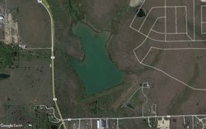 Aerial imagery from 2021 (prior to construction activities) 
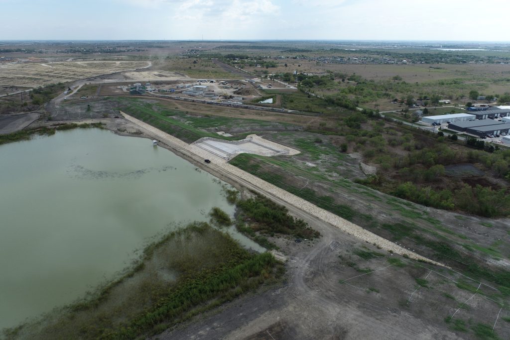
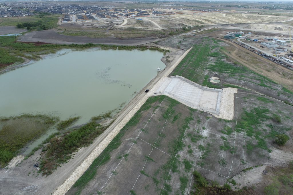
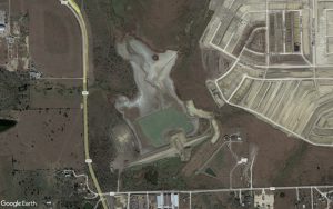 Aerial imagery from 2022 (during construction)
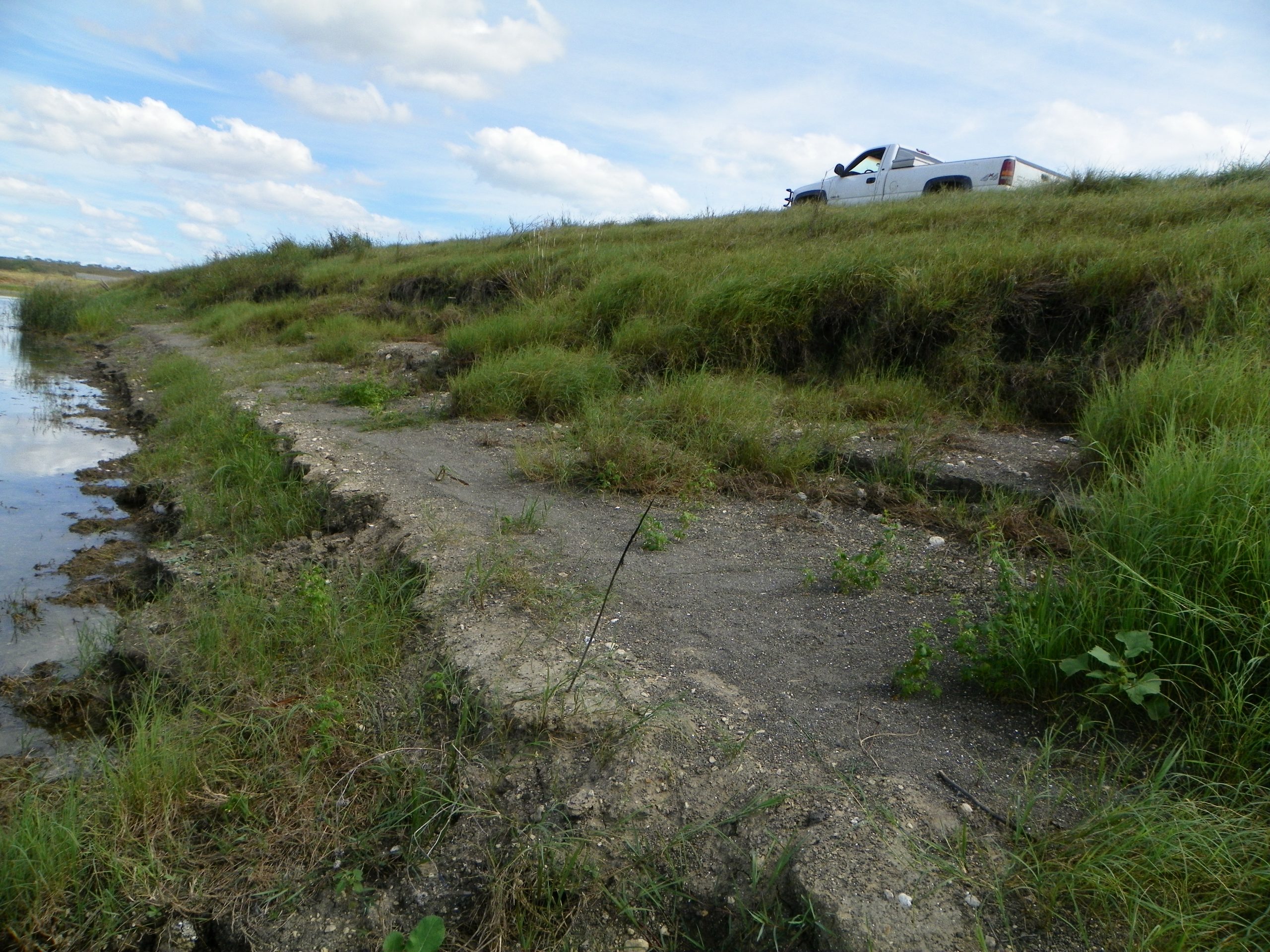 Upstream wave berm erosion
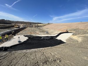
Subgrade preparation prior to RCC placement
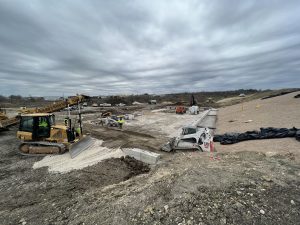 RCC being placed
Dam and spillway looking South
Dam and spillway looking East
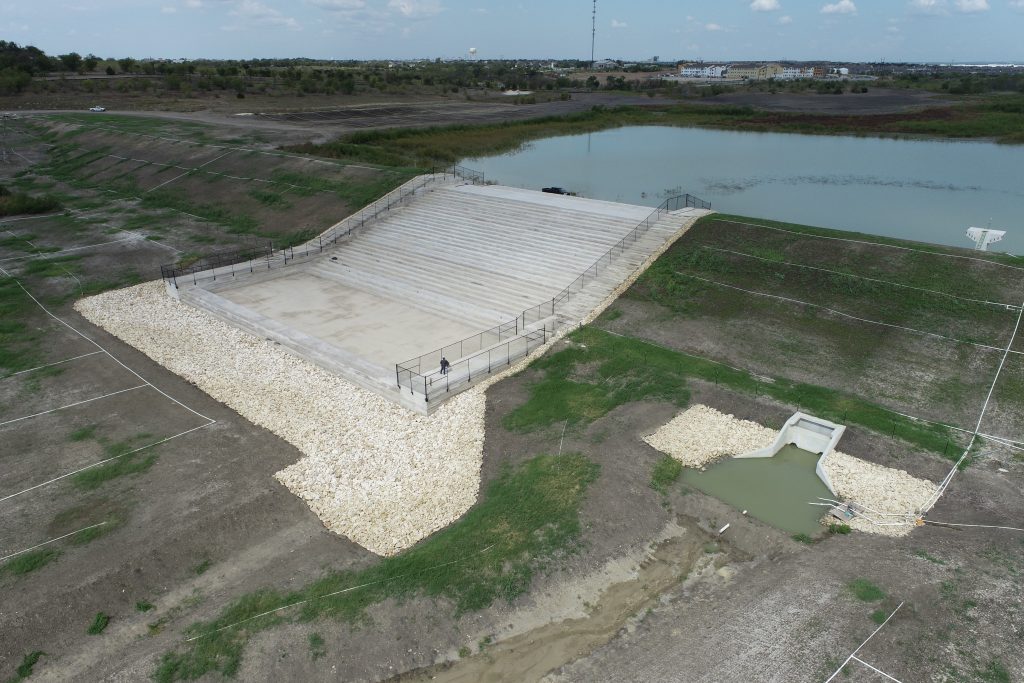
RCC and Principal Spillway works looking upstream (North)