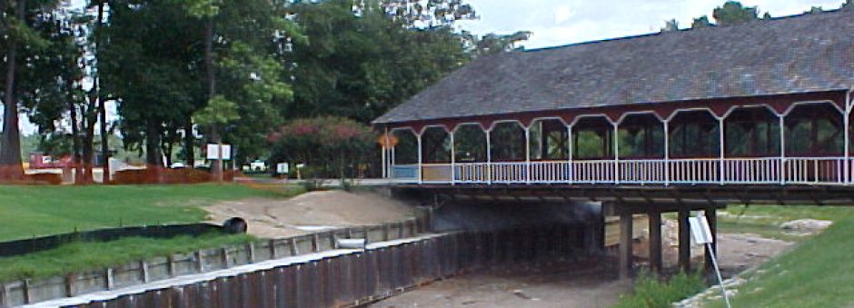
The project is located in the vicinity of the covered bridge at the entrance to the River Plantation development and in the vicinity of the Mosswood Bridge approximately 750 feet downstream. Both sites are on Stewarts Creek within approximately ½ mile of its confluence with the San Jacinto River and within a few hundred feet of Interstate Highway 45 about 3 miles south of Conroe, TX. During high flow flood events the fine sand soil within the bed is believed to become fluid for a significant depth below the streambed. This allows the sandy soil being retained by timber retaining walls to “flow” out from under the timber sheets leaving voids and threatening the integrity of the bridges.
The proposed remedial work consists of steel sheet piling at the base of the timber retaining walls to contain the soil material tending to flow out during flood events and serve as a barrier between the bank material and the fluid material below the channel bed during periods of high flow. A full height steel sheet pile wall upstream of the covered bridge is also included to tie off the work into the right upstream bank. Field survey information was collected with total station equipment by Rice Inspection Inc.
The characteristics of the sand in the channel bed indicate the depth to which the bed material becomes fluid is up to 8 feet below grade based on evaluation by John Fripp of the NRCS National Design, Construction and Soil Mechanics Center, Fort Worth.
A drop inlet drain structure is to be installed on the right bank immediately downstream of the covered bridge to control the local runoff which is currently getting behind the timber wall under the bridge. Repair of the timber wall in the immediate area where this uncontrolled flow has contributed to its failure is to be accomplished and the void behind the wall filled with low strength controlled material (flowable fill).
-
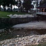
- Existing Failed Retaining Wall
-
- New Retaining Wall Protecting Bridge Abutment
-
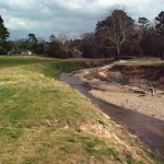
- Creek Bank Erosion
-
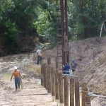
- Installing Soldier Piles
-
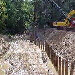
- Installing Soldier Piles
-
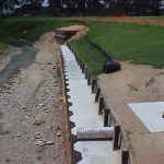
- Side-Inlet Drainage Structure
-
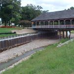
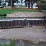
- New Retaining Wall Downstream of Bridge