M&E Consultants was engaged by Texas State Soil and Water Conservation Board (TSSWCB) and Natural Resources Conservation Service (NRCS) to prepare the detailed design for the rehabilitation of the dam originally constructed in 1960. The dam is located in Williamson County, Texas approximately 8.0 miles south of downtown Taylor or 0.5 miles east southeast of Coupland, Texas. Originally designed for floodwater detention and sediment retention the dam was built as a low hazard structure in an agricultural area. There has been some development downstream of FRS No. 32. The Texas Commission on Environmental Quality (TCEQ) and the United States Department of Agriculture (USDA), the NRCS (formally Soil Conservation Service (SCS), both concur that Upper Brushy Creek Watershed FRS No. 32 is a high hazard structure based on current criteria.
The selected alternative for rehabilitation was the installation of a 30-inch diameter conduit principal spillway system and impact basin outlet, maintaining the crest elevation of the auxiliary spillway and increasing its width from 100 to 120 feet plus raising the top of dam by 1.7 feet and flattening the downstream slope to 3 horizontal (H) to 1 vertical (V). The work plan also proposed that the existing 17-inch principal spillway inlet be removed and the conduit to be abandoned by filling the inside with concrete grout. During the design process, Texas NRCS recommended another option to a reservoir inlet be considered because of previous problems with the construction of reservoir inlets on soft foundation caused by storage of water in the reservoir. An embankment inlet was considered, but the low height of the required inlet did not place the inlet into the embankment a sufficient distance to assure there would not be construction issues. The principal spillway system selected is a structure similar to a hooded inlet principal spillway that has been previously installed on many Texas rehab projects. The existing principal spillway system will be left in place to serve as the de-watering mechanism for the floodwater retarding structure. The original installation of the principal included an orifice plate placed at the principal spillway crest, but was removed by the sponsors. The orifice plate will be reconstructed as originally designed. The trash rack will also be replaced.
The NRCS conducted a field survey in 2014 to determine current elevations of FRS No. 32. M&E Consultants performed the bathometric survey in May 2014. The surveys were performed using North American Datum of 1983 (NAD83) and North American Vertical Datum of 1988 (NAVD88). GPS survey instrument calibrated to the State Plane Coordinate System (SPCS) was employed for the survey. Williamson County is in the Central Zone of the SPCS. The GPS data was processed using Online Positioning User Service (OPUS). OPUS processes GPS data files with the same models and tools which help manage the nation’s Continuously Operating Reference Station (CORS) network, resulting in highly accurate and consistent coordinates that can be utilized among varying project stakeholders. The level of survey performed exceeds the minimum required by NRCS for the type of construction to be performed.
-

- Existing Principal Spillway Inlet and Reservoir
-

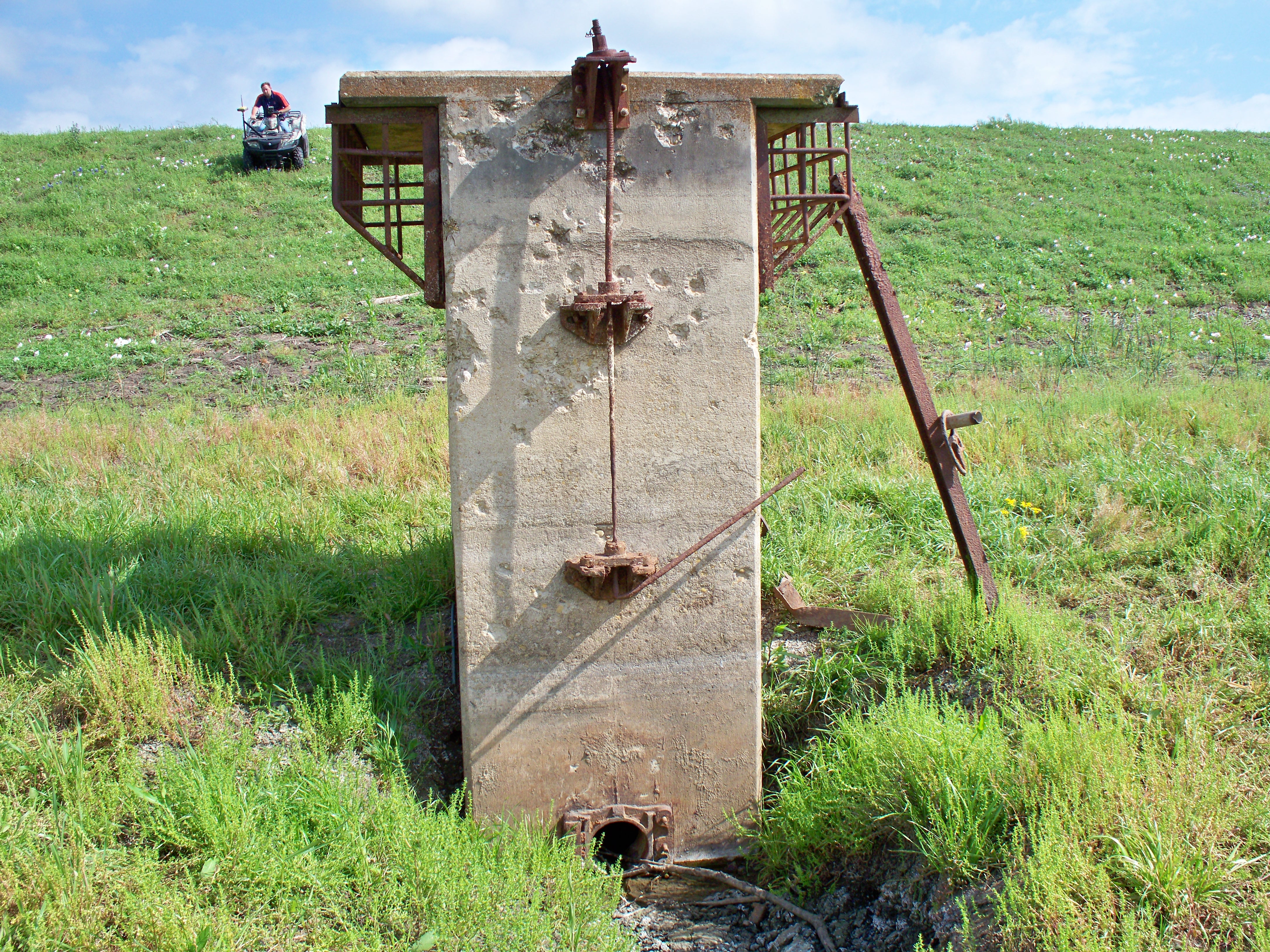
- Existing Principal Spillway Inlet
-

- Existing Principal Spillway Inlet, Repairs were made to amend the bullet holes.
-

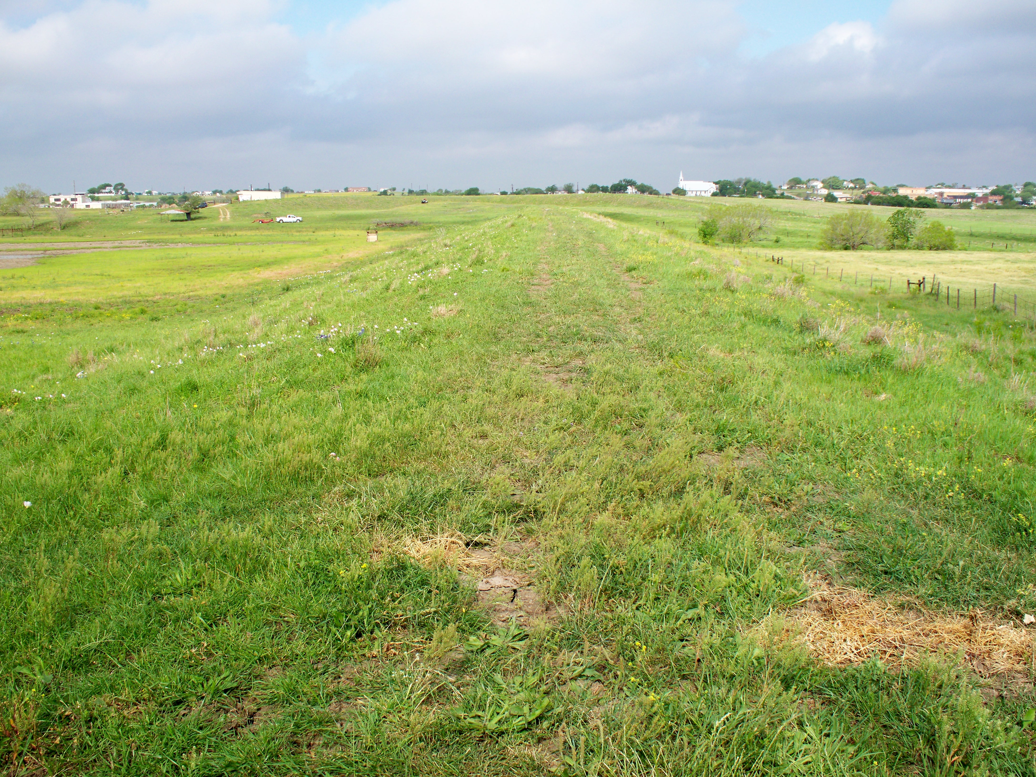
- Existing Top of Dam
-

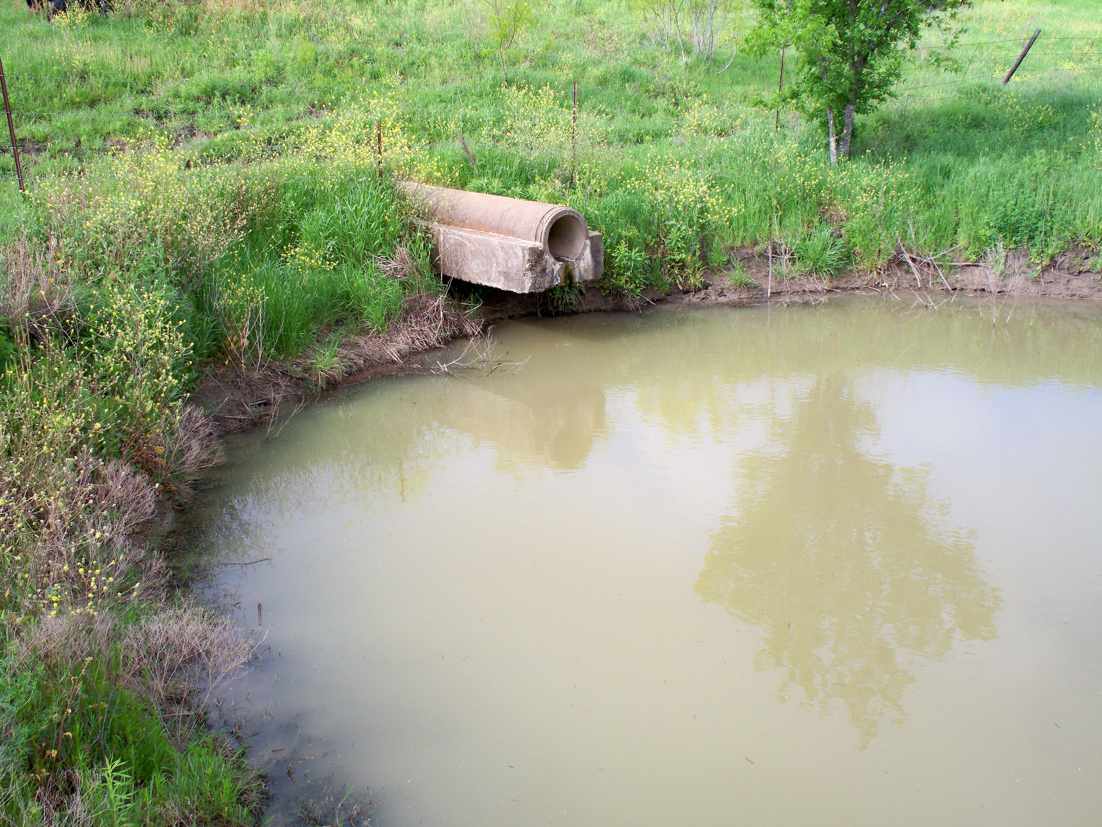
- Existing Principal Spillway Outlet Works
-
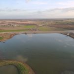
- Overview of Site
-

- Upstream Slope
-

- Overview of Site
-
- Overview of Site
-
- Overview of Site
-
- Widened Auxiliary Spillway
-

- Overview of Site
-

- New Principal Spillway Impact Basin and Existing Principal Spillway Pipe Modifications